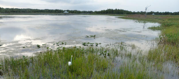
Review of wetland formation and topography
In the Peten region there are principally two types of agricultural terrains: (1) uplands and (2) perennial or seasonal swampy floodplains. As mentioned before the lowland terrain is a relatively flat valley that experiences varying levels of inundation. The vegetation consists of grasses, rush sedges, and sawgrass with trees and shrubs sutiated on the highland boundaries [26]. The ecology of the wetland ecosystems is diverse and dependent on the surrounding environment for their formation.
The challenges of flooding Large canals compose the main water source which experience aggrading, creating a natural levee or embankment parallel to the canals. Beyond the natural
levee is the floodplain and adjacent to that we have the backswamps. The
natural levee marks where the greatest velocity is constricted thereby dropping
silt and sediment (usually clay deposits) within the floodplain and backswamp [12]. The backswamps and floodplains are usually bordered
by escarpments, which deposit additional sediments and run-off from the
uplands.
During flood periods the water levels swell past the natural water levee. The swelling creates a new temporary levee known as the floodplain. Depressions in the soil adjacent to the floodplain and body of water gather and hold excess flood water long after water levels recede, forming backswamp habitats. The natural levee restricts the flow of water where silt, sand or clay deposit along the floodplain and backswamp. Most field formation is produced from sedimentation of erosion and precipitation of calcium carbonate (gypsum) and calcium sulfate dihydrate as a result of evaporating groundwater [12]. Most wetland habitats have very poor soil and suffer sediment deposit from runoff of the highlands [12] |

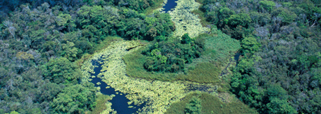
Figure 2: Model of a floodplain
Source: http://www.uwec.edu/jolhm/EH/Disrude/what%20is%20a%20floodplain.htm
|
Rainfall
The problems that these ecosystems posed were varying levels of water caused by varying elevations of sea levels (approx. 300 m/sal) and rainfall. As mentioned earlier in the introduction the average rainfall varies dramatically across the region of Mesoamerica, with as much as 1150 mm of difference within a 500 km distance [22]. The average annual rainfall is approximately 2000 mm/year in the Central Peten.
Heavy flood periods tend to create waterlogged conditions. Water-logging and the formation of peats over paleosol soil is typically characterized as soils of vertisol nature, which would be mineral deficient and susceptible to erosion of swelling floodplains (Kunen 2004: 6). The composition of the soil is further explained in the next section.
How did they deal with excess water?
The Central lowland Maya (CLM) dug canals, identified by aerial survey referred as lattices [12], to drain excess water to the flowing water sources nearby. The soil profile from the main wetland section demonstrates that the CLM continued to use wetland fields following stabilization. By digging these smaller canals they not only drained excess water but helped guard crops against root damage. The manipulation of the waterways also helped maximize usability as the digging of sub-soil was relocated on top of poorly mineralized soil.