What is wetland agriculture? Wetland agriculture in the Central Lowlands of the Peten consisted of using waterway resource areas as farmland. They used pieces of land adjacent to rivers, canals, creeks, and springs to build raised farm beds.
This was an intensive form of agriculture as it required time and constant management for productive farming. These areas were inundated seasonally or perennially throughout the year, which limited the availability of crop cultivation. However, generalized soil studies of ChanCahal, an area of the three river system: Hondo River, Blue Creek and Rio Bravo, suggest return activity of farming by the stratigraphic layering of peats, gypsum and paleosol soil. This demonstrates that the Maya had knowledge of the wetland ecosystems availability for the production of farming. [12] 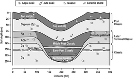
Figure 1: Demonstrates canal digging during different periods of Maya Civilization; source: [12]
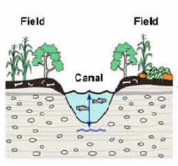
Figure 1: Demonstrates how a field would be arranged between drainage canals
Source: Beach, Time, et al. "A review of human and natural changes in Maya Lowland Wetlands over the Holocene." Quaternary Science Reviews 28, (2009): 1710-1724
|
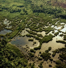
What are wetlands and where are they found? Wetlands are defined as low lying areas that are inundated at or near the soil surface by nearby bodies of water [Haak] . These areas are relatively flat valley bottoms that experience periodical inundation from flowing water sources (rivers, creeks, canals, springs). In the Central lowlands of the Petén wetlands and swamps are concentrated in the karstic depressions of the forest plains; which is a weathered and eroded limestone landscape. Today these wetlands are covered in dense vegetation ecosystems along river systems. [17]
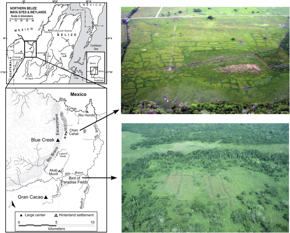
Figure 2: Aerial reconnaissance fieldwork: linear and quadratic features along the valley surface features; source [12]
|
Background:
Picture source:
http://www.geog.ubc.ca/~asiemens/research.htm
The wetland habitats are a result of biological processes and anthropogenic activity [16], which were determined to have been completed by the Classic Period to Early Classic Period 300 B.C. to 300 A.D. [12]. Studies conducted by researchers such as Siemens and Puleston, Pope and Dahlin, Luzzader-Beach and associates opened speculation to the development of intensive wetland agriculture as a subsistence strategy of the Central Lowland Maya.
In 1972 Siemens and Puleston conducted reconnaissance fieldwork in the Lowlands of the Peten, along the Calendaria River, which revealed a series of linear and quadratic feature patterns along river systems. These systems consisted of large waterways and smaller intricate canals, currently covered by the grass and bushes of the floodplains, It was the smaller patterns of linear and quadratic lines on the valley surface that led researchers to believe that agriculture activity was conducted along the waterways. They were within distances of larger known Maya sites and easily (possibly) inhabited by smaller populations villages [12].
In 1972 Siemens and Puleston conducted reconnaissance fieldwork in the Lowlands of the Peten, along the Calendaria River, which revealed a series of linear and quadratic feature patterns along river systems. These systems consisted of large waterways and smaller intricate canals, currently covered by the grass and bushes of the floodplains, It was the smaller patterns of linear and quadratic lines on the valley surface that led researchers to believe that agriculture activity was conducted along the waterways. They were within distances of larger known Maya sites and easily (possibly) inhabited by smaller populations villages [12].
